0
0
0

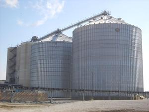
  IROQUOIS BIO-ENERGY COMPANY, LLC  

 
State Forecast for Rensselaer , IN
Change Zip Code: 
 
811
FPUS53 KIND 020114
ZFPIND
Zone Forecast Product for Indiana
National Weather Service Indianapolis IN
913 PM EDT Sun Oct 1 2023
INZ047-020800-
Marion-
Including the city of Indianapolis
913 PM EDT Sun Oct 1 2023
.REST OF TONIGHT...Clear. Lows in the upper 50s. East winds
around 5 mph.
.MONDAY...Sunny. Highs in the mid 80s. Southeast winds around
5 mph.
.MONDAY NIGHT...Clear. Lows around 60. Southeast winds around
5 mph.
.TUESDAY...Sunny. Highs in the mid 80s. Southeast winds 5 to
10 mph.
.TUESDAY NIGHT...Mostly clear through midnight, then becoming
partly cloudy. Lows in the lower 60s. Southeast winds around
5 mph.
.WEDNESDAY...Partly cloudy. Highs in the mid 80s.
.WEDNESDAY NIGHT...Mostly cloudy. A chance of showers toward
daybreak. Lows in the mid 60s. Chance of rain 30 percent.
.THURSDAY...Mostly cloudy with a slight chance of thunderstorms.
A chance of showers in the morning, then showers likely in the
afternoon. Not as warm with highs in the mid 70s. Chance of rain
60 percent.
.THURSDAY NIGHT...Partly cloudy. A chance of showers with a
slight chance of thunderstorms through midnight, then a slight
chance of showers toward daybreak. Cooler with lows in the mid
50s. Chance of rain 40 percent.
.FRIDAY AND FRIDAY NIGHT...Partly cloudy with a 20 percent chance
of showers. Highs in the upper 60s. Lows in the mid 40s.
.SATURDAY AND SATURDAY NIGHT...Mostly clear. Highs in the upper
50s. Lows around 40.
.SUNDAY...Partly cloudy. Highs around 60.
$$
INZ037-039-046-048-054>056-020800-
Boone-Hamilton-Hendricks-Hancock-Morgan-Johnson-Shelby-
Including the cities of Lebanon, Zionsville, Fishers, Carmel,
Noblesville, Plainfield, Brownsburg, Danville, Greenfield,
Martinsville, Mooresville, Greenwood, Franklin, and Shelbyville
913 PM EDT Sun Oct 1 2023
.REST OF TONIGHT...Clear. Patchy fog toward daybreak. Lows in the
mid 50s. East winds around 5 mph.
.MONDAY...Sunny. Highs in the mid 80s. Southeast winds around
5 mph.
.MONDAY NIGHT...Clear. Lows in the upper 50s. Southeast winds
around 5 mph.
.TUESDAY...Sunny. Highs in the mid 80s. Southeast winds 5 to
10 mph.
.TUESDAY NIGHT...Mostly clear through midnight, then becoming
partly cloudy. Lows in the lower 60s. Southeast winds 5 to
10 mph.
.WEDNESDAY...Partly cloudy. Highs in the mid 80s.
.WEDNESDAY NIGHT...Mostly cloudy. A chance of showers toward
daybreak. Lows in the mid 60s. Chance of rain 40 percent.
.THURSDAY...Mostly cloudy with a slight chance of thunderstorms.
A chance of showers in the morning, then showers likely in the
afternoon. Not as warm with highs in the lower 70s. Chance of
rain 60 percent.
.THURSDAY NIGHT...Partly cloudy. A chance of showers with a
slight chance of thunderstorms through midnight, then a slight
chance of showers toward daybreak. Cooler with lows in the lower
50s. Chance of rain 50 percent.
.FRIDAY AND FRIDAY NIGHT...Partly cloudy with a 20 percent chance
of showers. Highs in the upper 60s. Lows in the lower 40s.
.SATURDAY...Mostly sunny. A slight chance of showers in the
afternoon. Highs in the upper 50s. Chance of rain 20 percent.
.SATURDAY NIGHT AND SUNDAY...Mostly clear. Lows in the upper 30s.
Highs in the upper 50s.
$$
INZ021-028>030-035-036-020800-
Carroll-Warren-Tippecanoe-Clinton-Fountain-Montgomery-
Including the cities of Delphi, Flora, Williamsport,
West Lebanon, Lafayette, West Lafayette, Frankfort, Attica,
Covington, Veedersburg, and Crawfordsville
913 PM EDT Sun Oct 1 2023
.REST OF TONIGHT...Clear. Patchy fog toward daybreak. Lows in the
mid 50s. Southeast winds around 5 mph.
.MONDAY...Patchy fog in the morning. Sunny. Highs in the mid 80s.
Southeast winds around 5 mph.
.MONDAY NIGHT...Clear. Lows in the upper 50s. Southeast winds
around 5 mph.
.TUESDAY...Sunny. Highs in the mid 80s. South winds 5 to 10 mph.
.TUESDAY NIGHT...Mostly clear through midnight, then becoming
partly cloudy. Lows in the lower 60s. South winds 5 to 10 mph.
.WEDNESDAY...Partly cloudy. Highs in the mid 80s.
.WEDNESDAY NIGHT...Mostly cloudy. A slight chance of showers
through midnight, then a chance of showers with a slight chance
of thunderstorms toward daybreak. Lows in the lower 60s. Chance
of rain 50 percent.
.THURSDAY...Mostly cloudy in the morning, then becoming partly
cloudy. A slight chance of thunderstorms. A chance of showers in
the morning, then showers likely in the afternoon. Not as warm
with highs in the lower 70s. Chance of rain 70 percent.
.THURSDAY NIGHT...Partly cloudy. A chance of showers with a
slight chance of thunderstorms through midnight. Cooler with lows
around 50. Chance of rain 40 percent.
.FRIDAY AND FRIDAY NIGHT...Partly cloudy with a 20 percent chance
of showers. Highs in the mid 60s. Lows in the lower 40s.
.SATURDAY THROUGH SUNDAY...Mostly clear. Highs in the upper 50s.
Lows in the upper 30s.
$$
INZ031-038-020800-
Howard-Tipton-
Including the cities of Kokomo and Tipton
913 PM EDT Sun Oct 1 2023
.REST OF TONIGHT...Clear. Patchy fog toward daybreak. Lows in the
mid 50s. Southeast winds around 5 mph.
.MONDAY...Patchy fog in the morning. Sunny. Highs in the lower
80s. Southeast winds around 5 mph.
.MONDAY NIGHT...Clear. Lows in the upper 50s. Southeast winds
around 5 mph.
.TUESDAY...Sunny. Highs in the mid 80s. South winds 5 to 10 mph.
.TUESDAY NIGHT...Mostly clear through midnight, then becoming
partly cloudy. Lows in the lower 60s. Southeast winds 5 to
10 mph.
.WEDNESDAY...Partly cloudy. Highs in the mid 80s.
.WEDNESDAY NIGHT...Mostly cloudy. A slight chance of showers
through midnight, then a chance of showers toward daybreak. Lows
in the lower 60s. Chance of rain 40 percent.
.THURSDAY...Mostly cloudy with a slight chance of thunderstorms.
A chance of showers in the morning, then showers likely in the
afternoon. Not as warm with highs in the lower 70s. Chance of
rain 60 percent.
.THURSDAY NIGHT...Partly cloudy. A chance of showers with a
slight chance of thunderstorms through midnight, then a slight
chance of showers toward daybreak. Cooler with lows in the lower
50s. Chance of rain 40 percent.
.FRIDAY AND FRIDAY NIGHT...Partly cloudy with a 20 percent chance
of showers. Highs in the mid 60s. Lows in the lower 40s.
.SATURDAY...Partly cloudy with a 20 percent chance of showers.
Highs in the mid 50s.
.SATURDAY NIGHT...Mostly clear through midnight, then becoming
partly cloudy. Lows in the upper 30s.
.SUNDAY...Partly cloudy in the morning, then clearing. Highs in
the upper 50s.
$$
INZ040>042-049-020800-
Madison-Delaware-Randolph-Henry-
Including the cities of Anderson, Muncie, Winchester, Union City,
Farmland, Parker City, and New Castle
913 PM EDT Sun Oct 1 2023
.REST OF TONIGHT...Clear. Patchy fog toward daybreak. Lows in the
mid 50s. East winds around 5 mph.
.MONDAY...Patchy fog in the morning. Sunny. Highs in the lower
80s. Southeast winds around 5 mph.
.MONDAY NIGHT...Clear. Lows in the upper 50s. Southeast winds
around 5 mph.
.TUESDAY...Sunny. Highs in the mid 80s. Southeast winds 5 to
10 mph.
.TUESDAY NIGHT...Mostly clear. Lows around 60. Southeast winds
around 5 mph.
.WEDNESDAY...Partly cloudy. Highs in the mid 80s.
.WEDNESDAY NIGHT...Mostly cloudy. A chance of showers toward
daybreak. Lows in the lower 60s. Chance of rain 30 percent.
.THURSDAY...Mostly cloudy with a chance of showers. A slight
chance of thunderstorms in the afternoon. Not as warm with highs
in the lower 70s. Chance of rain 50 percent.
.THURSDAY NIGHT...A slight chance of thunderstorms through
midnight. Partly cloudy with a chance of showers. Cooler with
lows in the lower 50s. Chance of rain 50 percent.
.FRIDAY AND FRIDAY NIGHT...Partly cloudy with a 20 percent chance
of showers. Highs in the mid 60s. Lows in the lower 40s.
.SATURDAY...Partly cloudy with a 20 percent chance of showers.
Highs in the mid 50s.
.SATURDAY NIGHT...Mostly clear. Lows in the upper 30s.
.SUNDAY...Partly cloudy. Highs in the upper 50s.
$$
INZ057-065-020800-
Rush-Decatur-
Including the cities of Rushville and Greensburg
913 PM EDT Sun Oct 1 2023
.REST OF TONIGHT...Clear. Patchy fog toward daybreak. Lows in the
mid 50s. East winds around 5 mph.
.MONDAY...Sunny. Highs in the mid 80s. East winds around 5 mph.
.MONDAY NIGHT...Clear. Lows in the upper 50s. East winds around
5 mph.
.TUESDAY...Sunny. Highs in the mid 80s. Southeast winds around
5 mph.
.TUESDAY NIGHT...Mostly clear. Lows in the lower 60s. Southeast
winds around 5 mph.
.WEDNESDAY...Partly cloudy. Highs in the mid 80s.
.WEDNESDAY NIGHT...Partly cloudy through midnight, then mostly
cloudy with a slight chance of showers toward daybreak. Lows in
the mid 60s. Chance of rain 20 percent.
.THURSDAY...Mostly cloudy with a chance of showers. A slight
chance of thunderstorms in the afternoon. Highs in the mid 70s.
Chance of rain 50 percent.
.THURSDAY NIGHT...A slight chance of thunderstorms through
midnight. Partly cloudy with a chance of showers. Cooler with
lows in the mid 50s. Chance of rain 50 percent.
.FRIDAY AND FRIDAY NIGHT...Partly cloudy with a 20 percent chance
of showers. Highs in the upper 60s. Lows in the lower 40s.
.SATURDAY...Mostly sunny. A slight chance of showers in the
afternoon. Highs in the upper 50s. Chance of rain 20 percent.
.SATURDAY NIGHT AND SUNDAY...Mostly clear. Lows in the upper 30s.
Highs in the upper 50s.
$$
INZ043>045-051>053-020800-
Vermillion-Parke-Putnam-Vigo-Clay-Owen-
Including the cities of Clinton, Fairview Park, Rockville,
Montezuma, Rosedale, Greencastle, Terre Haute, Brazil, Spencer,
and Gosport
913 PM EDT Sun Oct 1 2023
.REST OF TONIGHT...Clear. Patchy fog toward daybreak. Lows in the
upper 50s. East winds around 5 mph.
.MONDAY...Patchy fog in the morning. Sunny. Highs in the mid 80s.
Southeast winds around 5 mph.
.MONDAY NIGHT...Clear. Lows in the upper 50s. Southeast winds
around 5 mph.
.TUESDAY...Sunny. Highs in the upper 80s. Southeast winds 5 to
10 mph.
.TUESDAY NIGHT...Partly cloudy. Lows in the lower 60s. Southeast
winds 5 to 10 mph.
.WEDNESDAY...Partly cloudy. Highs in the mid 80s.
.WEDNESDAY NIGHT...Mostly cloudy. A slight chance of showers
through midnight, then a chance of showers with a slight chance
of thunderstorms toward daybreak. Lows in the mid 60s. Chance of
rain 50 percent.
.THURSDAY...Mostly cloudy in the morning, then becoming partly
cloudy. A slight chance of thunderstorms. A chance of showers in
the morning, then showers likely in the afternoon. Not as warm
with highs in the lower 70s. Chance of rain 70 percent.
.THURSDAY NIGHT...Partly cloudy. A chance of showers with a
slight chance of thunderstorms through midnight. Cooler with lows
in the lower 50s. Chance of rain 40 percent.
.FRIDAY...Partly cloudy. A slight chance of showers in the
afternoon. Highs in the upper 60s. Chance of rain 20 percent.
.FRIDAY NIGHT...Partly cloudy through midnight, then clearing.
Lows in the lower 40s.
.SATURDAY THROUGH SUNDAY...Mostly clear. Highs around 60. Lows in
the upper 30s.
$$
INZ060-067-068-020800-
Sullivan-Knox-Daviess-
Including the cities of Sullivan, Carlisle, Shelburn,
Farmersburg, Vincennes, and Washington
913 PM EDT Sun Oct 1 2023
.REST OF TONIGHT...Clear. Lows in the upper 50s. East winds
around 5 mph.
.MONDAY...Sunny. Highs in the upper 80s. Southeast winds around
5 mph.
.MONDAY NIGHT...Clear. Lows in the upper 50s. Southeast winds
around 5 mph.
.TUESDAY...Sunny. Highs in the upper 80s. South winds 5 to
10 mph.
.TUESDAY NIGHT...Partly cloudy. Lows in the lower 60s. Southeast
winds around 5 mph.
.WEDNESDAY...Partly cloudy. Highs in the upper 80s.
.WEDNESDAY NIGHT...Mostly cloudy. A slight chance of showers
toward daybreak. Lows in the mid 60s. Chance of rain 20 percent.
.THURSDAY...Mostly cloudy with a chance of showers with a slight
chance of thunderstorms. Not as warm with highs in the mid 70s.
Chance of rain 50 percent.
.THURSDAY NIGHT...Partly cloudy. A chance of showers with a
slight chance of thunderstorms through midnight, then a slight
chance of showers toward daybreak. Cooler with lows in the mid
50s. Chance of rain 40 percent.
.FRIDAY...Partly cloudy. A slight chance of showers in the
afternoon. Highs around 70. Chance of rain 20 percent.
.FRIDAY NIGHT...Partly cloudy through midnight, then clearing.
Cooler with lows in the mid 40s.
.SATURDAY...Mostly sunny. Highs in the lower 60s.
.SATURDAY NIGHT...Clear. Lows around 40.
.SUNDAY...Mostly sunny. Highs in the mid 60s.
$$
INZ062-063-069>071-020800-
Monroe-Brown-Martin-Lawrence-Jackson-
Including the cities of Bloomington, Nashville, Loogootee,
Shoals, Bedford, Mitchell, and Seymour
913 PM EDT Sun Oct 1 2023
.REST OF TONIGHT...Clear. Patchy fog toward daybreak. Lows in the
upper 50s. East winds around 5 mph.
.MONDAY...Sunny. Highs in the mid 80s. East winds around 5 mph.
.MONDAY NIGHT...Clear. Lows in the upper 50s. East winds around
5 mph.
.TUESDAY...Sunny. Highs in the upper 80s. Southeast winds around
5 mph.
.TUESDAY NIGHT...Mostly clear through midnight, then becoming
partly cloudy. Lows in the lower 60s. Southeast winds around
5 mph.
.WEDNESDAY...Partly cloudy. Highs in the mid 80s.
.WEDNESDAY NIGHT...Mostly cloudy. A slight chance of showers
toward daybreak. Lows in the mid 60s. Chance of rain 20 percent.
.THURSDAY...Mostly cloudy. A slight chance of showers in the
morning, then a chance of showers with a slight chance of
thunderstorms in the afternoon. Not as warm with highs in the mid
70s. Chance of rain 50 percent.
.THURSDAY NIGHT...Partly cloudy. A chance of showers with a
slight chance of thunderstorms through midnight, then a slight
chance of showers toward daybreak. Lows in the mid 50s. Chance of
rain 50 percent.
.FRIDAY...Partly cloudy with a 20 percent chance of showers.
Highs in the upper 60s.
.FRIDAY NIGHT...Partly cloudy. Cooler with lows in the mid 40s.
.SATURDAY THROUGH SUNDAY...Mostly clear. Highs in the lower 60s.
Lows around 40.
$$
INZ064-072-020800-
Bartholomew-Jennings-
Including the cities of Columbus and North Vernon
913 PM EDT Sun Oct 1 2023
.REST OF TONIGHT...Clear. Lows in the mid 50s. East winds around
5 mph.
.MONDAY...Sunny. Highs in the mid 80s. East winds around 5 mph.
.MONDAY NIGHT...Clear. Lows in the upper 50s. East winds around
5 mph.
.TUESDAY...Sunny. Highs in the mid 80s. Southeast winds around
5 mph.
.TUESDAY NIGHT...Mostly clear. Lows in the lower 60s. Southeast
winds around 5 mph.
.WEDNESDAY...Partly cloudy. Highs in the mid 80s.
.WEDNESDAY NIGHT...Partly cloudy through midnight, then mostly
cloudy with a slight chance of showers toward daybreak. Lows in
the mid 60s. Chance of rain 20 percent.
.THURSDAY...Mostly cloudy. A slight chance of showers in the
morning, then a chance of showers with a slight chance of
thunderstorms in the afternoon. Highs in the upper 70s. Chance of
rain 50 percent.
.THURSDAY NIGHT...Partly cloudy. A chance of showers with a
slight chance of thunderstorms through midnight, then a slight
chance of showers toward daybreak. Lows in the mid 50s. Chance of
rain 50 percent.
.FRIDAY...Partly cloudy with a 20 percent chance of showers.
Highs in the upper 60s.
.FRIDAY NIGHT...Partly cloudy. Cooler with lows in the mid 40s.
.SATURDAY THROUGH SUNDAY...Mostly clear. Highs in the lower 60s.
Lows in the upper 30s.
$$
INZ061-020800-
Greene-
Including the cities of Linton, Bloomfield, Jasonville,
and Worthington
913 PM EDT Sun Oct 1 2023
.REST OF TONIGHT...Clear. Patchy fog toward daybreak. Lows in the
upper 50s. East winds around 5 mph.
.MONDAY...Patchy fog in the morning. Sunny. Highs in the upper
80s. Southeast winds around 5 mph.
.MONDAY NIGHT...Clear. Lows in the upper 50s. East winds around
5 mph.
.TUESDAY...Sunny. Highs in the upper 80s. Southeast winds 5 to
10 mph.
.TUESDAY NIGHT...Mostly clear through midnight, then becoming
partly cloudy. Lows in the lower 60s. Southeast winds around
5 mph.
.WEDNESDAY...Partly cloudy. Highs in the upper 80s.
.WEDNESDAY NIGHT...Mostly cloudy. A chance of showers toward
daybreak. Lows in the mid 60s. Chance of rain 30 percent.
.THURSDAY...Mostly cloudy with a chance of showers with a slight
chance of thunderstorms. Not as warm with highs in the mid 70s.
Chance of rain 50 percent.
.THURSDAY NIGHT...Partly cloudy. A chance of showers with a
slight chance of thunderstorms through midnight, then a slight
chance of showers toward daybreak. Cooler with lows in the mid
50s. Chance of rain 40 percent.
.FRIDAY...Partly cloudy. A slight chance of showers in the
afternoon. Highs in the upper 60s. Chance of rain 20 percent.
.FRIDAY NIGHT...Partly cloudy. Cooler with lows in the mid 40s.
.SATURDAY THROUGH SUNDAY...Mostly clear. Highs in the lower 60s.
Lows around 40.
$$
DTN Weather
Local Weather
Radar
County Forecast
State Forecast
DTN Weather Commentary
US Satellite
Current Surface Analysis
Wind Conditions
Today's Forecast Highs
Tonight's Forecast Lows
24 Hr Surface Forecast
Jet Stream Forecast
24 Hr Rainfall Estimate
24 Hr StormPath Accum
48 Hr StormPath Accum
6-10 Day Temp Forecast
6-10 Day Precip Forecast
Thunderstorm Outlook
US Drought Monitor
US Palmer Drought Index
US Crop Moisture Index
US Growing Degree Days
Soil Temperatures
Hurricane Tracking

DTN Weather Summary

Bryce Anderson image
Bryce Anderson – DTN Meteorologist
Scattered Showers for Northern Plains Friday

Scattered showers, thunderstorms for Northern Plains into Minnesota. Temperatures climb ahead of front. » More DTN Weather Commentary

Posted at 5:38AM Fri Sep 29, 2023 CDT
Click here to get your local weather emailed to you each day.
Copyright DTN. All rights reserved. Disclaimer.
Powered By DTN